

This is a recording of a presentation on the Gulf Hypoxia Initiative delivered by Easten Tallgrass Prairie and Big Rivers LCC Science Coordinator Gwen White at the 2016 International American Society of Agronomy, Crop Science Society of America, and Soil Science Society of America Annual Meeting, November 7, 2016 in Phoenix, Arizona.
Resources
LCCs have produced a wealth of informational documents, reports, fact sheets, webinars and more to help support resource managers in designing and delivering conservation at landscape scales.

Date posted: January 27, 2017

Speakers:
Bonnie Magnuson-Skeels, UC Davis Center for Watershed Sciences
Wesley Walker, UC Davis Center for Watershed Sciences
Date posted: January 18, 2017

This newsletter features: Steering Committee conference call details and logistics, coastal wetland decision support tool roll-out, and other news.
Date posted: January 17, 2017

Presenter: Meg White, The Nature Conservancy
Date posted: January 17, 2017

The Cultural Resources Climate Change Strategy addresses climate change across the National Park System and is aimed at helping park managers and scientists plan and implement responses.
Date posted: January 11, 2017
The South Atlantic LCC January 2017 newsletter features a save the date for a Blueprint workshop, review of a new seabird indicator, a mid-year review of the cooperative, and more.
Date posted: January 9, 2017

Discover how the Appalachian LCC’s new science tools can help you! The Appalachian LCC has developed a series of short videos showcasing the LCC’s science tools and products that are designed to help conservation partners in planning and decision making efforts.
Date posted: January 9, 2017

As resource managers and decision makers face a future in which many decisions and scenarios include increased complexity and uncertainty, this new paper published in Conservation Letters proposes several ways in which participants can best work alongside one another in an integrated system, here called coproduction.
Date posted: January 5, 2017

This document provides a synthesis of all Appalachian LCC funded research project deliverables such as decision support tools, data layers, final reports, and other vital information that will help plan and manage for the conservation of aquatic and terrestrial systems throughout the region.
Date posted: January 4, 2017
A Conservation Assessment of Canada's Boreal Forest Incorporating Alternate Climate Change Scenarios

Ecologically based strategies for climate change adaptation can be constructively integrated into a terrestrial conservation assessment for Canada's boreal forest, one of Earth's largest remaining wilderness areas. Identifying solutions that minimize variability in projected vegetation productivity may represent a less risky conservation investment by reducing the amount of anticipated environmental change.
Date posted: December 29, 2016

The Plowprint Report, which includes both a general information and technical version, has been developed to broaden public awareness of grasslands loss, and to offer a consistent way for the conservation community to track year-to-year grassland conversion to cropland across the focal regions of the Mississippi River Basin and Great Plains. This is the first edition of the report, which will be released on an annual basis.
Date posted: December 28, 2016

The Yukon Ecological and Landscape Classification Program released this Yukon Ecosystem and Landscape Classification and Mapping Guidelines report.
The guidelines were developed as a means to support a consistent, Yukon-specific approach to ecosystem classification and mapping. They present a common ELC framework specific to Yukon landscapes and vegetation. This supports land and resource management and fosters better coordination between resource sectors and managers.
Date posted: December 23, 2016
Date posted: December 22, 2016

Responding to population pressures, fragmentation and other stressors that threaten long-term sustainability of coastal resources in the Great Lakes region, the Upper Midwest and Great Lakes Landscape Conservation Cooperative has acted to unify federal agencies, state agencies and non-governmental organizations to form a Coastal Conservation Working Group.
Date posted: December 21, 2016

Speaker: Dr. Luke Hunt, American Rivers Director of Headwaters Conservation
Description: The deeply-eroded channel through Indian Valley (Alpine County) was filled in 2012 using the plug and pond technique to reconnect the channel to the historic floodplain. After restoration, the previously-intermittent stream has flowed continuously, despite California's historic drought.
Date posted: December 20, 2016

This story map produced by the Pacific Islands Climate Change Cooperative reveals many of the challenges and opportunities for Hawaiian native forest birds in the 21st century.
Date posted: December 13, 2016

The Pacific Islands Climate Change Cooperative (PICCC) supports a number of projects throughout the broad Pacific region, focusing on specific islands and atolls in Hawaiʽi, American Samoa, Federated States of Micronesia, Commonwealth of the Northern Mariana Islands, Guam, the Republic of Palau, and the Marine National Monuments.
Date posted: December 13, 2016

This interactive website integrates multiple story maps and graphics about the Southwest Florida region to display anticipated changes to natural and built areas through 2060, and management options.
Date posted: December 13, 2016

This story map, produced by the Pacific Islands Climate Change Cooperative provides detailed information about the President’s Resilient Lands and Waters Initiative (RLWI) in Hawai’i as well as RLWI partnership landscapes.
Date posted: December 13, 2016

The Southeast Conservation Adaptation Strategy (SECAS) is a shared, long-term vision for the conservation future of the Southeast and Caribbean region of the United States. Through SECAS, diverse partners are working together to design and achieve a connected network of landscapes and seascapes that supports thriving fish and wildlife populations and improved quality of life for people.
Date posted: December 13, 2016

This report from the twenty member tribes of the Northwest Indian Fisheries Commission focuses on the impacts of climate change to homelands, waters, and ways of life. These tribes have a historical and contemporary relationship with the watersheds and ecosystems of the Pacific Ocean coast, the Strait of Juan de Fuca, Hood Canal, and Puget Sound. Virtually all of the resources and activities that treaties protect—fishing, gathering, and hunting—are impacted by the effects of climate change.
Date posted: December 12, 2016
The Coastal Wetland Prioritization Tool provides information on the ecological condition, water quality, surrounding human pressures and conservation status of coastal wetlands. Through an intuitive interface, it allows coastal wetland managers to view the data, and select variables of interest, prioritize and report results.
Date posted: December 12, 2016
The Great Lakes Coastal Wetland Restoration Assessments help coastal wetland managers consider the broader context of their local conservation opportunities by identifying specific areas with high potential for restoration, comparing results with basemaps and oblique aerial photography and generating reports on areas of interest.
The tool allows coastal wetland managers to determine which lands are most conducive for restoration back to coastal wetland by using a restorability index model that factors in criteria such as:
Date posted: December 12, 2016

December ETPBR LCC Steering Committee Meeting and Activity Update.
Date posted: December 8, 2016
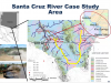
Stakeholder participation is a foundation of good water governance. In the Upper Santa Cruz River basin in Arizona, USA, the University of Arizona Water Resources Research Center (WRRC) convened a project aimed at providing scientific underpinnings for groundwater planning and management. In this project, entitled Groundwater, Climate, and Stakeholder Engagement (GCASE), stakeholders provided critical input to hydrologic modeling analyses using an innovative modeling framework for the Upper Santa Cruz River basin near Nogales, AZ.
Date posted: December 7, 2016

The National Fish Habitat Partnership has released their latest This Assessment Report, released by the National Fish Habitat Partnership, summarizes all the human impacts on fish habitats in the rivers and estuaries of the United States. It evaluates the risk and major drivers of habitat degradation within major subregions, as well as individual watersheds and estuaries.
Date posted: December 7, 2016

The LCC Network Lookout is our updated e-newsletter highlighting the latest stories from the Landscape Conservation Cooperatives.
Date posted: November 29, 2016

Landscape Conservation Planning and Design Workshop webinar for the Transboundary Madrean Watershed. Webinar highlights
- Existing data and resource management plans in the pilot area: We will highlight findings from our data call including the BLM's Rapid Ecological Assessments
- What to expect from the LCPD workshops Sept 21-22: We will go over the planned agenda for our meeting, as well as what to expect and what to do to prepare for the 2-day workshop
This webinar will be presented in both Spanish and English concurrently.
Date posted: November 27, 2016

Presenters: The webinar will be presented by Louise Misztal, Maureen Correll, and Colleen Whitaker of DLCC Landscape Conservation Planning and Design Core Team. Webinar co-presenters who are leading coordination of the pilot area include Russell Martin with Texas Parks and Wildlife Department, Jeff Bennett with the National Park Service, and Alfredo Rodriguez Pineda with the World Wildlife Fund. We will be providing the webinar in bi-lingual format with both Spanish and English.
Date posted: November 27, 2016

Presenters: The webinar will be presented by Louise Misztal, Maureen Correll, and Tahnee Robertson of the DLCC Landscape Conservation Planning and Design Core Team. Webinar co-presenters who are leading coordination of the pilot area include Juan Carlos Bravo with Wildlands Network and Peter Else with the Lower San Pedro Conservation Alliance.
Date posted: November 26, 2016

Reporting on activities and achievement for the Great Northern Landscape Conservation Cooperative in 2015.
Date posted: November 18, 2016

Presenter: Dr. Patrick Crist, NatureServe
The NatureServe Vista® is an extension to ArcGIS that supports complex assessment and planning in any environment, anywhere that has data sufficient for your planning needs. The tool helps managers and planners assess impacts on a variety of natural, cultural, and development objectives, and create options for sites, and entire landscapes and seascapes.
Date posted: November 18, 2016

Presenter: Lisa Johnson, Boise State University
Date posted: November 18, 2016
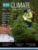
The North Pacific LCC co-produced the 2016 Northwest Climate Magazine with the Northwest Climate Science Center and the Climate Impacts Research Consortium. The 2016 edition features stories from the NPLCC, NW CSC, CIRC, similar to the 2015 edition and this year includes new stories from the Great Basin LCC, Great Northern LCC, and a NW CSC Graduate Fellow. This year's theme focuses on water availability in the Northwest.
Date posted: November 17, 2016

Federal agencies, working together with states, tribes, and other partners, designated seven Resilient Lands and Waters Partnerships across the country during the spring and summer of 2015: California Headwaters, California's North-Central Coast and Russian River Watershed, Crown of the Continent (northern Rocky Mountains), Great Lakes Coastal Wetlands (Lakes Huron & Erie), Hawaii (West Hawai'i, West Maui, and He'eia (O'ahu)), Puget Sound's Snohomish River Watershed, and Southwest Florida.
Date posted: November 17, 2016
This draft document identifies and defines the responsibilities of and procedures to be followed by the four main components of the LCC Structure: the Steering Committee, Strategic Subcommittees, Work Groups and Work Group Task Teams, and LCC Staff.
Date posted: November 17, 2016

This document serves as the guiding document for the Upper Midwest and Great Lakes LCC for the next five years.
Date posted: November 16, 2016

Speaker: Dr. Karen Thorne, USGS, WERC, San Francisco Bay Estuary Field Station
Date posted: November 9, 2016

The National Park Service published a Coastal Adaptation Strategies Handbook that summarizes the current state of NPS climate adaptation and key approaches for use in coastal parks. It includes case studies from Hurricane Sandy response and recovery strategies, including changes to infrastructure. Another chapter features practical coastal infrastructure information, including cost per unit length of constructed features like seawalls, beach nourishment, and nature-based solutions.
Date posted: November 7, 2016

On November 4, 2016, Dr. Peter Adler, Utah State University, discussed how sagebrush sensitivity to climate change varies across the region and the strengths and weaknesses of various climate modeling approaches. Healthy big sagebrush habitat is essential for the persistence of many high value conservation species across the western US. To gain confidence in predictions of climate change impacts on existing populations of big sagebrush, a research team from Utah State University compared output from four modeling approaches, each based on very different data and assumptions.
Date posted: November 5, 2016

This Science Plan will serve as an action-oriented blueprint for acquiring scientific information needed to restore and conserve the imperiled ‘sagebrush sea,’ a roughly 500,000-square-mile area of sagebrush steppe habitat across western North America.
Date posted: November 1, 2016

This brief report highlights the major accomplishments of the Eastern Tallgrass Prairie and Big Rivers LCC in 2015 and 2016 and features insights regarding the value of collaboration from Steering Committee co-chairs and membership.
Date posted: November 1, 2016

GCPO LCC mark (logo), color and font guidance and resources for use in promotions and publications.
Date posted: November 1, 2016

This is combined presentation of two recently completed GCPO LCC-sponsored projects that address how to manage open pine savanna and woodlands to enhance wildlife habitat and biodiversity. The first project, “Developing and Applying Desired Forest Condition (DFC) Metrics for Open Pine Ecosystems” was recently completed by Rickie White, Project Manager/Ecologist with NatureServe.
Date posted: October 31, 2016

A special issue of the journal of the George Wright Society focusing on landscape-scale conservation in North America features an article highlighting the unique role that LCCs play in addressing conservation challenges that require coordination and collaboration across vast geographies. South Atlantic LCC staff served as co-authors and contributed a write-up on the South Atlantic Conservation Blueprint!
Date posted: October 31, 2016

Gulf Coastal Plains & Ozarks LCC staff created a spatial data layer of all known examples of natural prairie within their geography, using spatial datasets derived from a variety of sources. The spatial data layer initially shows observed and noted prairies in Alabama, Arkansas, Mississippi, and Missouri with no records of prairie patches for parts of the GCPO outside of these states. Partners are encouraged to provide feedback in the comments section of the map on the CPA. The comments tab allows the user to draw polygons, lines and points in addition to written comments.
Date posted: October 31, 2016

Great Lakes Inform is a free, online platform designed to increase the efficiency of regional conservation and resource management in the Great Lakes. Great Lakes Inform is a “first-stop” shop to find, share, and access information that helps you address key Great Lakes issues.
Great Lakes Inform provides the following services.
Date posted: October 28, 2016

Spatial data for assessing the integrity of freshwater systems in the Green River Basin was identified as an information need by GRB LCD participants. Integrity of freshwater systems is key for informing management decisions within a watershed context. In this webinar, Dr. Dave Theobald and Dr. Dylan Harrison-Atlas will discuss their process-based approach to integrate data on local and cumulative drivers of freshwater integrity including future change agents.
Date posted: October 27, 2016
Many media reports share a story of bleak decline for quaking aspen across the western U.S. The cause for this "aspen decline" (defined differently across newspapers) ranges, and includes: cool wet climates, warm dry climates, fire suppression, livestock, elk, fir encroachment, rampant development, ozone, recreation and radio waves. With such a wide range of reported causes and scenarios, what is the actual condition of aspen trees, and how might we expect this far-flung species to react to projected changes?
Date posted: October 27, 2016

Land managers are responsible for developing effective strategies for conserving and restoring Great Basin ecosystems in the face of invasive species, conifer expansion, and altered fire regimes. A warming climate is magnifying the effects of these threats and adding urgency to implementation of management practices that will maintain or improve ecosystem functioning.
Date posted: October 26, 2016