

The Appalachian LCC has collaborated with the US Forest Service to provide information and tools that fully integrate society’s value of ecosystems with future threats to better inform natural resource planning and management. Through links on this page, users can access information, maps, data, and additional resources brought together through this collaboration.
Resources
LCCs have produced a wealth of informational documents, reports, fact sheets, webinars and more to help support resource managers in designing and delivering conservation at landscape scales.

Date posted: June 24, 2016

The Landscape Conservation Cooperative undertakes work specific to the needs of the geography and collaborators. This strategic plan documents the vison, mission, guiding principles, and goals of the PPP LCC. Each element of the plan plays a role in defining the direction and function of the LCC over the coming years. Vision describes the future we work to create, mission the purpose of the LCC, and guiding principles set sideboards for how we hope to achieve the vision and mission. Three goals—addressing partnership, collaboration, and communication—set the broad course we will follow.
Date posted: June 17, 2016

These 12 conservation practice sheets are initial drafts and proof-of-concept papers that work to define and illustrate high-impact, multiple benefit practices. Generated by expert working teams over the course 2015 and early 2016, these conservation practice sheets are still undergoing review and the list of practices is currently being expanded.
Date posted: June 10, 2016

This report details analysis conducted by scientists from the University of Alaska Fairbanks, U.S. Geological Survey and the U.S. Forest Service. They calculate Alaska's greenhouse gas potential and predict that plant growth in Alaska should store as much carbon as the state loses to wildfire and thawing permafrost through 2100.
Date posted: June 2, 2016
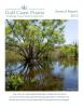
Reporting on activities and achievement for the Gulf Coast Prairie Landscape Conservation Cooperative in 2015.
Date posted: May 31, 2016

Reporting on activities and achievement for the Great Plains Landscape Conservation Cooperative in 2015.
Date posted: May 31, 2016

Speaker Jim Thorne, UC Davis Information Center for the Environment, will provide an overview of a UC Davis-California Department of Fish & Wildlife project "A Climate Change Vulnerability Assessment of California's Terrestrial Vegetation" that was completed earlier this year as part of the 2015 update to California's State Wildlife Action Plan.
Date posted: May 31, 2016

Users of the conservation planning tool are able to access information about status, threats, and conservation opportunities based on their priorities, indicating where management is best located to benefit their species of interest, and additionally, they are able to compare the best management practices for their species of interest, indicating how they should implement management to benefit those species.
Date posted: May 26, 2016

This geospatial tool contains a wealth of geospatial products, including water quality layers, agricultural system layers, geophysical layers, fish and wildlife focal areas, and many others. All told, over 100 different geospatial layers are organized within the MRB/GHI group, making it easy for Databasin users to locate the datasets that they’re most interested in. And, because it’s in Databasin, it’s super easy to create custom maps and to add other geospatial layers that might be
Date posted: May 26, 2016

A two-page overview of the multi-LCC Mississippi River Basin / Gulf Hypoxia Initiative covering the goals, objectives, and next steps for the Initiative.
Date posted: May 25, 2016

The Peninsular Florida LCC Conservation Planning Atlas is a data discovery, visualization, and analytical platform for stakeholders throughout the Peninsular Florida area. With the PFLCC CPA you can search for spatial datasets, visualize supported projects, and learn more about landscape scale conservation science and design in the region.
Date posted: May 16, 2016
Phil van Mantgem, Research Ecologist, USGS Redwood Field Station and Donald Falk, University of Arizona, School of Natural Resources and Environment, present information on current and planned research on fire and drought interactions in coniferous forests in California and the Southwest while gathering managers’ input on planned projects and idenitifying key knowledge gaps regarding patterns of tree survivorship, mortality, and regeneration in treated and untreated areas.
Date posted: May 4, 2016

Over the past few years, the USFWS R6 Science Applications program has been able to support several important research studies to increase our understanding of the response of sagebrush ecosystems in a changing world. We have been able to support these studies through a variety of funding sources including Inter-LCC Science Funding, our partnership with the Western Association of Fish and Wildlife Agencies (WAFWA) and the USGS Science Support Program.
Date posted: May 3, 2016

We discuss a strategic approach developed by an interagency, Western Association of Fish and Wildlife Agencies working group for conservation of sagebrush ecosystems, Gunnison sage-grouse, and greater sage-grouse.
Date posted: April 29, 2016

We're pleased to share with you the April issue of the LCC Network Lookout, our updated e-newsletter highlighting the latest stories from the Landscape Conservation Cooperatives and partners.
Date posted: April 22, 2016

The latest publication in the Great Basin LCC's fact sheet series focusing on seeding techniques for sagebrush restoration after fire. The fact sheet outlines important considerations and options for post-fire seeding, including the selection of seed mixes and seeding equipment for restoring sagebrush communities following fire. References and resources are offered for greater detail and guidance on specific topics.
Date posted: April 21, 2016

The 2015 annual report is organized to report achievements and progress in implementing the GCPO LCC's five long-range strategies:
Date posted: April 20, 2016

Reporting on activities and achievement for the North Atlantic Landscape Conservation Cooperative in 2015.
Date posted: April 13, 2016

How can we shift from reactive to proactive conservation planning in northern regions, and what does it look like? Fiona Schmiegelow, Kim Lisgo, Pierre Vernier, and Alberto Suarez-Esteban of the BEACONs project recently presented applications of the Conservation Matrix Model (CMM), and the process of applying it.
Date posted: April 7, 2016

In 2012, Region 6 of the US Fish and Wildlife Service (USFWS) obtained Inter-LCC Science Funding to support original research and development of decision support tools to further landscape-scale conservation of Greater sage-grouse within and across the four Landscape Conservation Cooperatives (LCC) comprising the birds’ range. USFWS partnered with Western Association of Fish and Wildlife Agencies (WAFWA) to deliver this program.
Date posted: April 4, 2016
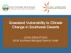
Climate change predictions include warming and drying trends, which are expected to be particularly pronounced in the southwestern United States. In this region, grassland dynamics are tightly linked to available moisture, yet it has proven difficult to resolve what aspects of climate drive vegetation change.
Date posted: March 29, 2016

Core Team volunteers from the Technical Advisory Groups (TAGs) have drafted these FY16 Business Plans as updates for implementing the ETPBR LCC Operations and Strategic Plan.
These are living documents, open to revision, depicting the emerging landscape-scale conservation needs across the Tallgrass Prairie LCC geography.
Date posted: March 23, 2016

Speakers:
Date posted: March 22, 2016

The Gulf Coast Prairie LCC Conservation Planning Atlas is a platform that allows users to discover, access and integrate existing spatial data layers and maps for use in analysis and conservation planning.
Date posted: March 18, 2016

The South Atlantic CPA is a free mapping portal designed to share regional spatial data. You can overlay multiple layers, create and export maps, and download data. In addition to the Conservation Blueprint, you'll find information about connectivity, protected lands, urban growth, and much more.
Date posted: March 15, 2016

This document highlights the major accomplishments of the past year, including Blueprint 2.0, the Simple Viewer, the State of the South Atlantic, and many exciting success stories where the Blueprint helped bring new conservation dollars to the region.
Date posted: March 8, 2016

Summary of Science Research Projects Funded by the Great Plains Landscape Conservation Cooperative Completed Through 2015
The Great Plains Landscape Conservation Cooperative funds science research to better understand the ecological processes required for conservation of wildlife within the Great Plains. These research project summaries were written by the Great Plains Landscape Conservation Cooperative to inform partners and the greater public of the important research funded through the Great Plains Landscape Conservation Cooperative.
Date posted: March 2, 2016

California Department of Fish & Wildlife and UC Davis has completed "A Climate Change Vulnerability Assessment of California's Terrestrial Vegetation". This report assesses 29 natural vegetation types in California across four alternate projected climates by the end of the century.
Date posted: February 23, 2016

Speaker: Jered Hansen, Southern Rockies LCC
Date posted: February 18, 2016
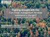
Last year, the USDA Regional Climate Hubs released their first Hub-wide product, the Climate Hubs Tool Shed. The Tool Shed is an online, searchable database of tools to assist in adapting working lands to the impacts of climate change. While many of the tools were developed specifically to address climate change, several were instead developed to aid in mitigating impacts of drought, pests, wildfire, and extreme weather.
Date posted: February 14, 2016

While the science of environmental flows is ever-growing and expanding, there are few compendiums of efforts to define the quantity of water needed to maintain riparian and aquatic species. In 2015 the Desert Landscape Conservation Cooperative provided support to the University of Arizona Water Resources Research Center (WRRC) and Northern Arizona University to create such a compendium for the DLCC geography. The Desert Flows Database summarizes key data from over 400 studies on riparian and aquatic species and provides users with a one-stop-shop for available (published) information.
Date posted: February 11, 2016

Southeast Aquatic Connectivity Assessment Project (SEACAP) map and prioritization tool are designed to be screening-level tools that can be used to help investigate potential fish passage / aquatic organism passage opportunities in the Southeast United States in the context of many ecological factors.
Date posted: January 29, 2016

The Chesapeake Fish Passage Prioritization project was designed to help managers identify potential fish passage projects that are most likely to produce ecological benefits. Results include three consensus-based scenarios that depict dams in the 64,000 square mile Chesapeake Bay watershed where passage projects would provide the greatest potential benefit for diadromous fish, resident fish, and brook trout, respectively. Additionally, an interactive map and tool allows users to examine results in the context of other relevant data, develop custom scenarios, and to model the effects of cond
Date posted: January 29, 2016

The network of sea lamprey barriers consists of purpose-built barriers as well as numerous dams constructed for other purposes that also serve to block upstream migration of adult sea lampreys. The location and design of purpose-built barriers are determined by a team of experts and are generally designed to block adults while allowing jumping fish to pass safely.
Date posted: January 29, 2016

Fishworks is a web-based GIS platform that allows users to access sophisticated optimization tools that identify barriers which, if removed, would maximize habitat improvements for migratory fish in the Great Lakes Basin. On Fishworks, users can decide which barriers are optimized and the cost and benefits that are considered in the optimization, and then visualize the results.
Date posted: January 20, 2016
Presenters: Dave Peterson, U.S. Forest Service Pacific Northwest Research Station and Jessica Halofsky, University of Washington
SPECIAL NOTE: This webinar will reach attendee capacity. Space is limited to the first 100 people logged in day of webinar, not date of registration. If you are registered and can’t get into the webinar, we will send you an email with the recording link in one week. We appreciate your understanding.
Date posted: January 20, 2016

This report provides a hydrogeomorphic (HGM) evaluation of ecosystem restoration options for the Lower Missouri River (LMR) floodplain from River Mile (RM) 670 south of Decatur, Nebraska to RM 0 at St. Louis, Missouri. This LMR floodplain covers 680 river miles and about 1.5 million acres. While currently free-flowing, the LMR today is highly regulated by upstream reservoirs and water-control protocols and the river channel is greatly restricted and altered in a channelized form.
Date posted: January 11, 2016
The South Atlantic LCC square and rectangular logos.
Date posted: January 1, 2016

This Charter defines the mission and vision for the Great Lakes Region Aquatic Habitat Connectivity Collaborative, as well as roles and decision making procedures.
Date posted: December 28, 2015

The El Niño Southern Oscillation (ENSO) describes warming sea surface temperatures in the Pacific Ocean that typically correspond with cool and wet precipitation events in California and the Lower Colorado River Basin during an El Niño event. The latest El Niño episode is projected to be one of the strongest, if not the strongest on record, garnering significant attention from the public, media, and water resource managers throughout the U.S.
Date posted: December 2, 2015

This is the primary access to the LC MAP Data Catalog tool, powered by ScienceBase. LC MAP was originally developed by the U.S. Geological Survey in coordination with multiple partners and is broadly available for ScienceBase users to share, access, and analyze common datasets. LC MAP was developed to aid resource managers share data across partners agencies and perform intensive geospatial analysis on a landscape scale.
Date posted: November 20, 2015

Economies need nature. Economic development and quality of life depend upon natural capital. Natural capital produces economically valuable tangible goods, such as food, water, timber and fish, as well as less tangible but still vitally important services, including flood risk reduction, drinking water filtration, recreation, and aesthetic value.
Date posted: November 18, 2015
Speakers: Jason Writer – University of Wyoming and Harry Crockett – Colorado Parks and Wildlife
The first part of this webinar will provide an introduction on the need for the development of the Inland Cutthroat Trout Viewing and Editing Web Application. This includes information about the Cutthroat Conservation and Recovery Teams and the value of the Inland Cutthroat Protocol for maintaining current information on species and habitat status, as well as other benefits.
Date posted: November 17, 2015

Climate, sea level rise, and urbanization are undergoing unprecedented levels of combined change and are expected to have large effects on natural resources—particularly along the Gulf of Mexico coastline (Gulf Coast). Management decisions to address these effects (i.e., adaptation) require an understanding of the relative vulnerability of various resources to these stressors. To meet this need, the four Landscape Conservation Cooperatives along the Gulf partnered with the Gulf of Mexico Alliance to conduct this Gulf Coast Vulnerability Assessment (GCVA).
Date posted: November 13, 2015
 management on Virgin River")
Amphibians and reptiles (herpetofauna) have been linked to specific microhabitat characteristics, microclimates, and water resources in riparian forests. Our objective was to relate variation in herpetofauna abundance to changes in habitat caused by a beetle used for Tamarix biocontrol (Diorhabda carinulata; Coleoptera: Chrysomelidae) and riparian restoration. From 2009-2014 we measured vegetation and monitored herpetofauna at locations affected by biocontrol along the Virgin River in the Mohave Desert of the southwestern USA.
Date posted: November 13, 2015

The Restoration Handbook for Sagebrush Steppe Ecosystems aids wildlife and habitat managers in developing strategies to prioritize where and how to invest in sagebrush steppe ecosystem restoration efforts. The handbook was produced by the Sagebrush Steppe Treatment Evaluation Project (SageSTEP) in collaboration with a team of inter-disciplinary researchers.
Date posted: October 26, 2015

The LCC Network Conservation Science Plan (Science Plan) advances a strategic conservation framework to identify and describe the common science and technical priorities and practices that transcend individual LCC geographies and support the LCC Network’s vision and mission.
Date posted: October 22, 2015

- The models generating these maps are the first to take into account the ability of marshes to accrete, or keep up with, rising sea levels, in the San Francisco Bay Estuary.
- Point Blue has generated a series of scenarios to provide a range of projections to address the uncertainty in future rates of sea-level rise and suspended sediment availability.
- Our maps cover the entire Estuary allowing for analyses at multiple spatial scales.
Date posted: October 14, 2015

The Nature Conservancy - with support from the Appalachian LCC - completed a study to assist policy makers, land management agencies, and industry in assessing potential future energy development and how that may overlap with biological and ecological values.
Date posted: October 9, 2015
This report represents the result of a 3-day Workshop of the Cooperative's Steering Committee and key Partners to produce a collaborative, integrated, and science-driven 5-Year Work Plan. It will serve as our guide in moving the Appalachian Landscape Conservation Cooperative forward to advance the efforts of the broader conservation community in addressing large-scale environmental and climate impacts.
Date posted: October 7, 2015