

Riparian ecosystems are among the most productive and diverse ecosystems in desert biomes. In the Sonoran, Chihuahuan, and Mojave deserts of the United States and Mexico, riparian ecosystems support regional biodiversity and provide many ecosystem services to human communities. Due to the dynamic nature of these ecosystems and their abundance of resources, riparian areas have been modified in various ways and to a large extent through human endeavor to manage water and accommodate various land uses, particularly in lowland floodplains and stream channels.
Resources
LCCs have produced a wealth of informational documents, reports, fact sheets, webinars and more to help support resource managers in designing and delivering conservation at landscape scales.
Date posted: June 23, 2018
We are providing geospatial data layers of climate, fire, biome and predicted species distributions for download at our project website. Links to presentations, data descriptions and zip files containing data layers can be found here. Over the next few months, we will continue to upload webinars and new training tutorials that demonstrate the application of these datasets to new questions and species.
Date posted: June 23, 2018
Sky Island Alliance (SIA) is a non-governmental organizational that works to protect and restore the rich natural heritage of native species and habitats in the Sky Island Region. We work with volunteers, scientists, land-owners, public officials, and government agencies to establish protected areas, restore healthy landscapes, and promote public appreciation of the region's unique biological diversity. Because of our long-standing collaborative relationships with land managers and our large corps of skilled volunteers, we were in a unique position to spearhead this project.
Date posted: June 23, 2018
Executive Summary: Our project combined field surveys of fish communities and habitat characteristics with estimates of population genetic structure to identify and evaluate critical factors influencing fish communities in the Gila River basin of New Mexico. Fish communities were structured along a strong habitat gradient associated with stream size, with distinct differences in the distribution of native and nonnative fishes. Nonnative warm-water species generally occurred in mainstem habitats, whereas coldwater nonnative salmonids occurred in high elevation tributaries.
Date posted: June 23, 2018
Executive Summary: Riparian ecosystems are vital components of the semi-arid landscape because woody riparian plants provide resources that are absent in adjacent vegetation types. Historically, flood played a key role in shaping the composition and structure of riparian forests. In recent decades, however, the frequency and magnitude of floods has decreased and the timing of peak discharge has been altered. In addition, wildfire has increased in importance as an agent of disturbance along many streams.
Date posted: June 23, 2018
Evaluation of Climate Change Impacts for the Southwest U.S. and Northern Mexico
Tool helps land managers visualize the projected impacts of a changing climate on birds and habitats.
Birds are closely linked to climate and vegetation. Because of this, they can provide early warnings of broader changes to come. PLuMA is an interactive, online tool that allows users to:
Date posted: June 23, 2018
Abstract: Topock Marsh is a large wetland adjacent to the Colorado River and the main feature of Havasu National Wildlife Refuge (Havasu NWR) in southern Arizona. In 2010, the U.S. Fish and Wildlife Service (FWS) and Bureau of Reclamation began a project to improve water management capabilities at Topock Marsh and protect habitats and species. Initial construction required a drawdown, which caused below-average inflows and water depths in 2010–11. U.S.
Date posted: June 23, 2018
Assessment Executive Summary: In the past decade there has been increased interest in providing water to meet the needs of riparian and aquatic ecosystems in the western United States and policymakers are using their knowledge of environmental flow needs to advocate for both political and scientific changes. However, there are significant challenges associated with including environmental flows in water management and planning.
Date posted: June 23, 2018
Executive Summary: We provide an analysis of Sonoran Desert water network connectivity to inform managers of current conditions for target wildlife and how the connectivity will change as the landscape becomes more water limited.
Date posted: June 23, 2018
Climate change predictions include warming and drying trends, which are expected to be particularly pronounced in the southwestern United States. In this region, grassland dynamics are tightly linked to available moisture, yet it has proven difficult to resolve what aspects of climate drive vegetation change.
Date posted: June 23, 2018
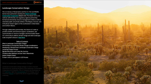
The Desert LCC's primary goal for landscape conservation planning and design is to "add value to, and further our partner’s ongoing work to build resource resilience in the face of climate change and other ecosystem stressors."
Date posted: June 23, 2018
Article Abstract: Although riparian and aquatic ecosystems make up a small fraction of the area in arid and semi-arid lands, they are critical for the survival of desert life. There are, however, few compendia of efforts to define the quantity of water needed to maintain these ecosystems and understand the risks and stressors to them. Through our analysis we found that 62% of the rivers examined in the deserts of the U.S.
Date posted: June 23, 2018
This project had two primary goals: 1) To develop a process for integrating data from multiple sources to improve predictions of climate impacts for wildlife species; and 2) To provide data on climate and related hydrological change, fire behavior under future climates, and species’ distributions for use by researchers and resource managers.
Date posted: June 23, 2018
Tabular data
Date posted: June 23, 2018
Article Introduction: Efforts to define water needs for riparian and aquatic ecosystems in arid and semi-arid systems are critical because riparian areas are essential for the survival of desert life, with stream corridors providing a large proportion of ecosystem services in these landscapes (Poff, Koestner, Neary, & Henderson, 2011; Millennium Ecosystem Assessment, 2005). To create a one-stop-shop for published ecological water needs information and illuminate critical knowledge gaps in the desert watersheds of the U.S.
Date posted: June 23, 2018
Southern Nevada Water Authority will add new modeling and analytical capabilities to tools developed as part of a previous WaterSMART Climate Analysis Tools Grant that assessed impacts of climate change on water quality and sediment transport in Lake Mead. Project results are intended to increase an understanding of how water quality characteristics and nutrient levels in Lake Mead may be affected by climate change.
Date posted: June 23, 2018
For more information about the data inventory:
Grasslands Conservation Geospatial Data Compilation and Synthesis
Date posted: June 23, 2018
ELCOM and CAEDYM are three-dimensional finite-difference codes; they were used to simulate three-dimensional transport and the interactions of flow, physics, biology, and chemistry in the reservoir.
Date posted: June 23, 2018
In September 2013 the Springs Stewardship Institute received funding from the BOR to map springs and springs-dependent species in the DLCC. Since then we have configured our server, migrated our geodatabase to an ArcSDE, and published several WMS and WFS to our domain at https://arcgis.springsdata.org/arcgis/rest/services .
Date posted: June 23, 2018
Webinar: Desert Water Harvesting Initiative - Guide to Assessing Rainwater and Stormwater Harvesting
Guide to Assessing Rainwater and Stormwater Harvesting Potential to Meet Multiple Challenges and Provide Multiple Benefits. The Water Resources Research Center established the Desert Water Harvesting Initiative to enhance outreach and communication between utilities, practitioners of water harvesting, academics, and interested citizens.
Date posted: June 23, 2018
Estimated potential for sage-grouse movement among sage-grouse leks (Circuitscape; McRae 2006). Rescaled HSI values were used as a measure of landscape resistance
Date posted: June 23, 2018
The purpose of this project was to develop a spatially explicit occupancy model for grizzly bears across the full extent of the CCE. The landscape occupancy model was created using ecological variables compiled for the CCE by the CMP and grizzly bear detection data provided by our partners in Alberta, British Columbia, and Montana. Our work identifies landscape-scale factors that influence grizzly bear occupancy and compliments other fine-scale modeling activities occurring elsewhere in the CCE.
Date posted: June 23, 2018
Habitat similarity index (HSI) values for greater sage-grouse across their western range. HSI values represent the relationship of environmental values at map locations to the multivariate model of minimum requirements for sage-grouse defined by land cover, anthropogenic variables, soil, topography, and climate.
Date posted: June 23, 2018
This includes the following data sets:
Pacific Northwest Riparian Climate Corridors: scores attributed to stream lines
Pacific Northwest Riparian Climate Corridors: HUC6 Scores by Omernik Ecoregions
Pacific Northwest Riparian Climate Corridors: scores attributed to HUC-6 watersheds
Potential Riparian Areas in the Pacific Northwest
Riparian Mapping Project - Index averaged to HUC 6
Date posted: June 23, 2018
Despite the lack of surface flows, the Colorado River riparian corridor in Mexico has proven to be ecologically resilient. Floods in the 1980s and 90s in the region brought back large swaths of native riparian habitat, which still persist today in some areas along the river.
Date posted: June 23, 2018
The Change, Aftereffect, Trend (CAT) transform is a multitemporal visualization of change on a landscape. Based on MODIS 16- day 250m Normalized Vegetation Index time series covering the Crown of the Continent from 2000-2010, the CAT transform captures both long- and short-term change over the time series, and produces a visually striking false colour visualization of landscape dynamics.
Date posted: June 23, 2018
We will develop an approach to identify fire refugia in Rocky Mountain ecosystems of the U.S. and Canada then test the function of refugia for biodiversity conservation under current and future climate/fire scenarios. Our products will be designed to inform decision-making in land/easement acquisition, identification of critical areas for maintaining landscape and process connectivity/permeability, and extension of the temporal context for spatial conservation decision making. The approach will be testable for transferability to other locations and ecosystems.
Date posted: June 23, 2018
The purpose of this project was to develop a spatially explicit occupancy model for grizzly bears across the full extent of the CCE. The landscape occupancy model was created using ecological variables compiled for the CCE by the CMP and grizzly bear detection data provided by our partners in Alberta, British Columbia, and Montana.
Date posted: June 23, 2018
Limber Pine Relative Probability of Occupancy Maps
Date posted: June 23, 2018
Additional reports describing key findings for 13 case studies (including 11 species, a vegetation system, and a region). These reports are provided as appendices to the overview report, and are intended to act as stand-alone resources.
Date posted: June 23, 2018
We will develop an approach to identify fire refugia in Rocky Mountain ecosystems of the U.S. and Canada then test the function of refugia for biodiversity conservation under current and future climate/fire scenarios. Our products will be designed to inform decision-making in land/easement acquisition, identification of critical areas for maintaining landscape and process connectivity/permeability, and extension of the temporal context for spatial conservation decision making. The approach will be testable for transferability to other locations and ecosystems.
Date posted: June 23, 2018
Climate grids for the extent of the GNLCC study area saved as asciis with a 2km resolution. These grids are saved in in the Albers Equal Area Conic projection. Summer is defined as months 7-9, while winter is defined as months 1-3. All grids with the exception of cmi.asc, dd5.asc, & growingsl.asc were produced in the program ClimateWNA, which downscales PRISM climate grids using a digital elevation model.
Date posted: June 23, 2018
We will develop an approach to identify fire refugia in Rocky Mountain ecosystems of the U.S. and Canada then test the function of refugia for biodiversity conservation under current and future climate/fire scenarios. Our products will be designed to inform decision-making in land/easement acquisition, identification of critical areas for maintaining landscape and process connectivity/permeability, and extension of the temporal context for spatial conservation decision making. The approach will be testable for transferability to other locations and ecosystems.
Date posted: June 23, 2018
This project identifies priority areas in the Columbia Plateau Ecoregion to implement conservation strategies for riverine and riparian habitat. This is tailored towards the Arid Lands Initiative (ALI) conservation goals and objectives, and provides the foundation for adaptation to a changing climate.
Date posted: June 23, 2018
We will develop an approach to identify fire refugia in Rocky Mountain ecosystems of the U.S. and Canada then test the function of refugia for biodiversity conservation under current and future climate/fire scenarios. Our products will be designed to inform decision-making in land/easement acquisition, identification of critical areas for maintaining landscape and process connectivity/permeability, and extension of the temporal context for spatial conservation decision making. The approach will be testable for transferability to other locations and ecosystems.
Date posted: June 23, 2018
Grids of principal component gradients and varimax-rotated components 1 & 2 for the extent of the GNLCC study area saved as asciis with a 2km resolution. PC1 and RC1 represent a latitudinal gradient of temperature, while PC2 and RC2 represent a longitudinal gradient of precipitation seasonality and continentality.
Date posted: June 23, 2018
We will develop an approach to identify fire refugia in Rocky Mountain ecosystems of the U.S. and Canada then test the function of refugia for biodiversity conservation under current and future climate/fire scenarios. Our products will be designed to inform decision-making in land/easement acquisition, identification of critical areas for maintaining landscape and process connectivity/permeability, and extension of the temporal context for spatial conservation decision making. The approach will be testable for transferability to other locations and ecosystems.
Date posted: June 23, 2018
Currently, dreissenid mussels have yet to be detected in the northwestern part of the United States and western Canada. Infestation of one of the jurisdictions within the mussel-free Pacific Northwest would likely have significant economic, societal and environmental implications for the entire region. Understanding the biology and environmental tolerances of dreissenid mussels, and effectiveness of various management strategies, is key to prevention.
Date posted: June 23, 2018
We will develop an approach to identify fire refugia in Rocky Mountain ecosystems of the U.S. and Canada then test the function of refugia for biodiversity conservation under current and future climate/fire scenarios. Our products will be designed to inform decision-making in land/easement acquisition, identification of critical areas for maintaining landscape and process connectivity/permeability, and extension of the temporal context for spatial conservation decision making. The approach will be testable for transferability to other locations and ecosystems.
Date posted: June 23, 2018
Great Northern Landscape Conservation Cooperative (GNLCC) study area boundary, as an ArcGIS shapefile, with an Albers Equal Area projection.
Date posted: June 23, 2018
The Western Governors’ Association has sponsored an assessment of crucial habitats which will be used for the evaluation of landscape-scale energy, land use, and transportation projects. The main purpose of the work funded through this LCC grant is to develop an index of aquatic ecological integrity and incorporate it into Washington State’s crucial habitats assessment. Ecological integrity has been defined as the ability of an ecological system to support and maintain a community of organisms that has species composition, diversity, and functional organization comparable to thos
Date posted: June 23, 2018
The Western Governors’ Association (WGA) sponsored an assessment of crucial habitats which will be used for the evaluation of landscape-scale energy, land use, and transportation projects throughout the western United States. The main product of the WGA’s assessment is an easily accessible online system of maps displaying crucial habitats and corridors known as the Crucial Habitat Assessment Tool (CHAT; http://www.westgovchat.org/).
Date posted: June 23, 2018
This project is part of a larger effort to design a sustainable landscape for wildlife and ecological systems in the Columbia Plateau ecoregion. Another goal of this effort is to test and describe different approaches to doing “Landscape Conservation Design” (LCD) and working towards articulating a toolkit of approaches for LCD. This report documents a task related to further develop and testing of this toolkit as applied to priority areas in the Columbia Plateau). This project focuses on a rapid assessment method of several potential areas across a large landscape.
Date posted: June 23, 2018
The zip file below contains raw input and output files for the 4 final version of the ALI Marxan model. The versions all have the same number of runs (100), number of iterations (35 million), SPF factor for each conservation feature,(100) and BLM (0.35). They vary in overall goal levels and whether or not facets were targeted. The four versions are: (1) high overall goal levels, facets not targeted;(2) medium overall goal levels, facets not targeted; (3) medium overall goal levels, facets not targeted; (4) medium overall goal levels, facets targeted at 15%.
Date posted: June 23, 2018
The Western Governors’ Association (WGA) sponsored an assessment of crucial habitats which will be used for the evaluation of landscape-scale energy, land use, and transportation projects throughout the western United States. The main product of the WGA’s assessment is an easily accessible online system of maps displaying crucial habitats and corridors known as the Crucial Habitat Assessment Tool (CHAT; http://www.westgovchat.org/).
Date posted: June 23, 2018
The ALI’s approach to coordinating conservation action starts with integrating the ALI’s shared priorities into partners’ implementation mechanisms, and moving to coordinated action on the ground. This approach includes three main thrusts:
1. Agreeing on where on the landscape to focus each of the six shared strategies, and on which areas and strategies partners are best able to make progress. This thrust will also include identifying stakeholders not currently working with the ALI, to start engaging them in implementation of projects.
Date posted: June 23, 2018
Grizzly Bear Occupancy Maps
Date posted: June 23, 2018